
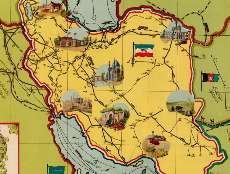
Using a rare 1945 map preserved in the collections of the National Library of Israel, we have created a guide to Iran from another era, a journey through picturesque cities, sacred sites, and a geopolitical landscape seasoned with a dash of Iranian grandiosity.

A “Pillbox” Tour of Jerusalem With the British Mandate Police
In 1920, the British Mandate authorities established the Palestine Police Force. Come take a step back in time as we trace the history of this key institution through rare photographs and period maps—focusing on its distinctive presence across Jerusalem.

Mapping 50 Years of Zionist Pioneering
The desert was pushed back, the swamps were dried up and water reached every corner of the land – this historic map celebrated 50 years of the Zionist enterprise…

The Age of Discovery as Reflected in Antique Maps
The Age of Discovery led to the broadening of human knowledge about the geography of the world we live in and landscapes and peoples in faraway regions in America and Asia. These discoveries are reflected in antique maps preserved in the National Library

Jerusalem’s First Tourist Map
Where did one go to watch a movie in British-Mandate era Jerusalem? Where could you catch a bus? And what were the popular hot spots? Presenting the map that resurrects pre-state Jerusalem…